Travel Guide
Where Is Zanzibar?
Zanzibar is an archipelago in the Indian Ocean, roughly 25–50 km off the coast of Tanzania in East Africa, just south of the equator.
Zanzibar's position on the globe
Zanzibar sits in the western Indian Ocean, a degree or so south of the equator at approximately 6°S, 39°E. It belongs to East Africa geographically and politically, forming a semi-autonomous part of Tanzania. The archipelago is close enough to the mainland to receive dhow traffic daily, yet far enough into the ocean to feel like a world apart — the trade winds, the coral reefs, and the palm-fringed shorelines all speak of the sea rather than the continent behind it.
On a world map, look for the broad bulge of East Africa's coastline. Tanzania occupies a long stretch of that coast between Kenya to the north and Mozambique to the south. Zanzibar lies directly east of Tanzania, floating in the channel between the mainland and the open ocean. The archipelago is clearly visible on any regional map of East Africa as a pair of islands — Unguja to the south and Pemba to the north — tucked close to the shore.
Relationship to Tanzania and Dar es Salaam
Zanzibar's main island, Unguja, lies roughly 35 kilometres east of Dar es Salaam, Tanzania's largest city and principal port. That gap is narrow enough for a fast ferry to cross in around 90 minutes, making Zanzibar one of the most accessible island destinations on the continent. Dar es Salaam's Julius Nyerere International Airport offers direct international connections, and many visitors fly onward to Zanzibar from there; Abeid Amani Karume International Airport on Unguja also receives direct international flights from Europe and the Gulf.
The Tanzanian mainland — historically called Tanganyika before the 1964 union — forms the backdrop to the west. To the north of Tanzania lies Kenya, whose own coast at Mombasa is roughly 450 km from Zanzibar. To the south, Mozambique's coastline extends down toward the Mozambique Channel.
The two main islands: Unguja and Pemba
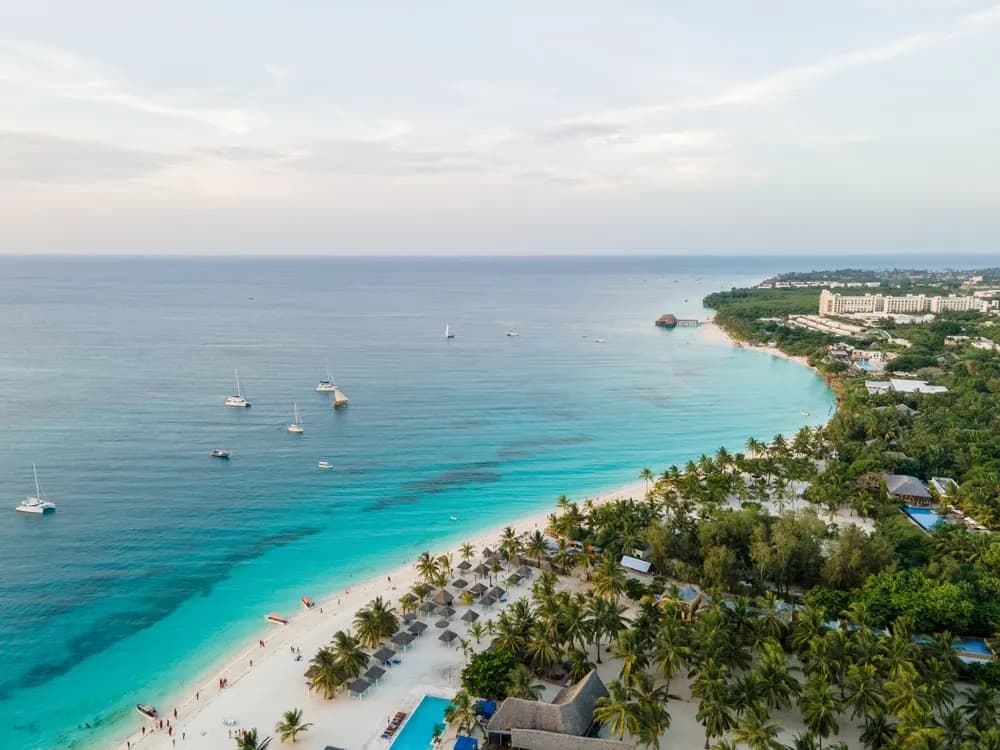
The Zanzibar Archipelago consists of two principal islands and a scattering of smaller islets and atolls. Unguja — commonly called "Zanzibar Island" because it is the seat of the capital and the main destination for visitors — lies at approximately 6°S and stretches about 85 km from north to south and 40 km at its widest. Stone Town, the historic capital, sits on the western coast of Unguja, facing back toward the mainland.
Pemba Island lies about 80 km to the north-northeast of Unguja, at approximately 5°S. Smaller and much less visited, Pemba is mountainous compared to the relatively flat Unguja, and it is renowned among divers for the dramatic wall dives along its western edge. The channel between Pemba and the mainland is called the Pemba Channel; the gap between Unguja and the mainland is sometimes called the Zanzibar Channel.
How to locate Zanzibar on a map
A simple way to find Zanzibar on any map of Africa: identify the east coast of the continent, then look directly offshore at the latitude of roughly 6 degrees south. The islands appear just below a horizontal line drawn through the northern tip of Tanzania and Mombasa in Kenya. This places Zanzibar well north of Madagascar (which lies far to the south-southeast), and well south of the Somali coast.
In terms of longitude, Zanzibar sits near 39°E — similar to Nairobi in Kenya, which lies at roughly 37°E, and close to Addis Ababa in Ethiopia at around 38°E. This gives a useful continental reference: Zanzibar is at roughly the same east–west position as the Great Rift Valley nations of eastern Africa, just relocated out to sea.
Proximity to the equator
At 6 degrees south of the equator, Zanzibar is firmly in the tropics. The equator itself passes through Kenya roughly 300 km to the north. This equatorial proximity explains the warm temperatures year-round (typically 25–32°C), the two rainy seasons driven by the Inter-Tropical Convergence Zone, and the southeast trade winds that blow reliably from June through October. The island has no winter in any meaningful sense — what varies is rainfall and wind, not temperature.
Zanzibar in the Indian Ocean context
Zanzibar is part of the broader western Indian Ocean world that stretches from the Gulf of Arabia down to the Mozambique Channel. This location made it the natural hub of the ancient Swahili coast trading network, which connected East Africa to Arabia, Persia, India, and beyond. The Monsoon winds — blowing northeast in winter and southwest in summer — made the crossing between Zanzibar and Oman or Gujarat predictable and reliable for centuries. Geographically, Zanzibar's position is the key to understanding both its history and its character.
Frequently asked questions
- Is Zanzibar in Africa?
- Yes. Zanzibar is an archipelago in the Indian Ocean that forms part of Tanzania, which is in East Africa.
- How far is Zanzibar from the mainland?
- The main island of Unguja lies roughly 35 km from Dar es Salaam, Tanzania's largest city. The crossing by fast ferry takes about 90 minutes.
- What are the coordinates of Zanzibar?
- The centre of Unguja island sits at approximately 6.165°S, 39.2026°E — just south of the equator in the western Indian Ocean.