Travel Guide
Zanzibar Map: Geographic Orientation
A verbal map of Zanzibar: Stone Town on the west coast, north beaches at Nungwi and Kendwa, the east coast at Paje, and Pemba Island 80 km to the north.
The shape of Unguja
Unguja — the main island, almost universally called "Zanzibar Island" — is an elongated slab of coral limestone and sand that runs roughly north to south. It is approximately 85 kilometres from its northern tip to its southernmost point, and up to 40 kilometres wide at its broadest, giving it a total land area of around 1,660 square kilometres. The island is low and flat for the most part, rarely rising above 120 metres, with a slightly higher ridge running down its centre that locals call the central ridge or the plateau zone. This modest elevation is enough to create slightly more fertile, forested interior terrain compared to the sandy coastal fringes.
The western coast faces the Tanzania mainland and the Zanzibar Channel. The eastern coast faces the open Indian Ocean. The northern tip points toward Pemba Island and the equator. The southern tip tapers toward the smaller islets of the outer Zanzibar Archipelago.
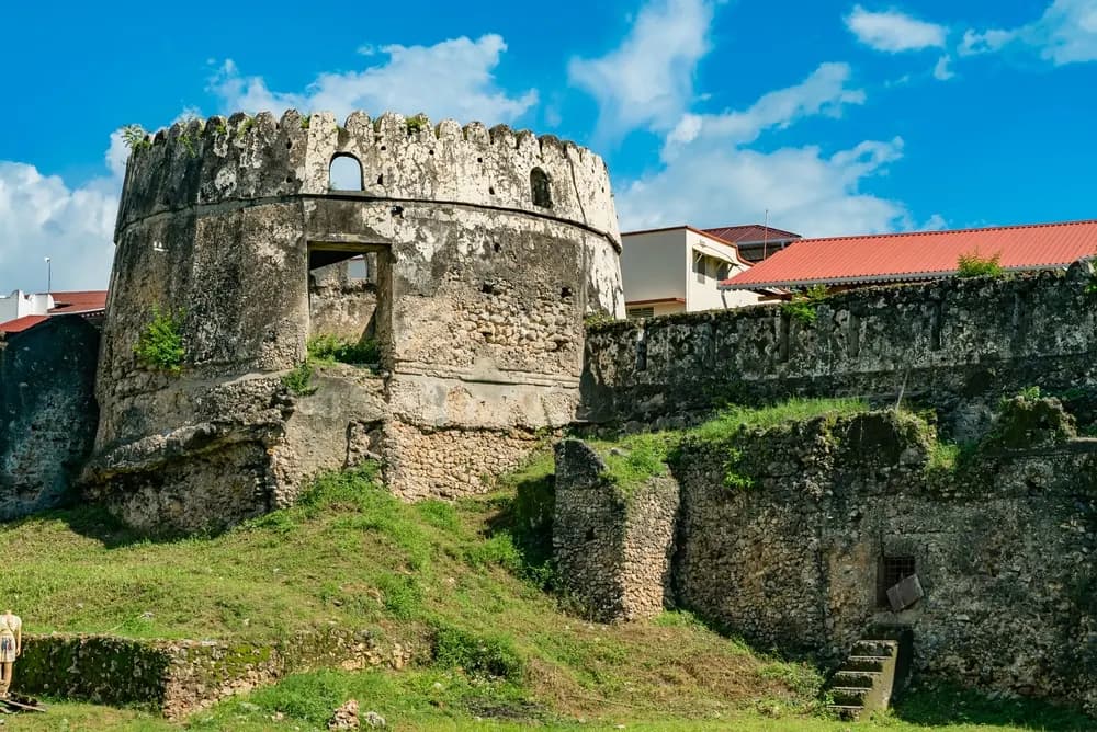
Stone Town and the western coast
Stone Town sits on a triangular peninsula that juts westward from the middle of Unguja's western coast — the closest point on the island to the Tanzania mainland. The city is compact: the old historic core covers barely a square kilometre, though the urban area extends further into the surrounding Ng'ambo district. The harbour faces northwest toward Dar es Salaam, and the fast ferry from the mainland docks at the main port in Stone Town, making it the arrival and departure point for most visitors.
South of Stone Town along the western coast, the shoreline is quieter, lined with mangroves and fishing villages. The town of Fuoni is just south of the urban boundary. Further south, Mbweni and the quieter western shore offer glimpses of the working coast away from the tourist trail.
The north coast: Nungwi and Kendwa
The northern tip of Unguja is Zanzibar's most visited coastal zone. Nungwi sits at the very top of the island, with beaches on both its western and eastern flanks; the village is one of Unguja's main dhow-building centres. A few kilometres south of Nungwi along the western shore is Kendwa — a smaller, quieter beach settlement that shares Nungwi's characteristic of having little tidal variation, meaning the sea stays swimmable at all hours.
The north coast is sheltered from the southeast trade winds that blow June through October, which is why these beaches remain calm and attractive during Zanzibar's peak season. Water temperatures are warm year-round, and snorkelling off the northern reef is consistently good.
The east coast: Paje, Jambiani, and Bwejuu
The east coast is long, flat, and dominated by a fringing coral reef that lies perhaps 300–500 metres offshore. At low tide, the reef exposes shallow lagoons across vast stretches of beach — beautiful to look at, but not swimmable until the tide comes in. This tidal pattern is most pronounced on the southeast coast. The main settlements from north to south on the east coast are Matemwe, Kiwengwa, Uroa, Chwaka, Paje, Bwejuu, and Jambiani.
Paje is the kitesurf capital of the Indian Ocean, and it has developed a lively traveller scene. Jambiani to the south is quieter, with long stretches of beach and local seaweed farming visible on the lagoon. Matemwe in the northeast has good reef access and is a base for Mnemba Atoll, which lies a few kilometres offshore.
The southeast and south
The southeastern corner of Unguja includes Kizimkazi, a village known for resident spinner and bottlenose dolphins and for an ancient Shirazi mosque that dates to the 12th century — one of the oldest standing mosques in East Africa. Jozani Chakawa Bay National Park occupies a central-south section of the island and protects the last significant area of indigenous forest, home to the endemic Zanzibar red colobus monkey.
Distances from the mainland and to Pemba
The narrowest point between Unguja and the Tanzanian mainland is roughly 35 kilometres — the crossing to Dar es Salaam by fast catamaran. Stone Town to Dar es Salaam port is about a 90-minute ferry ride; to the smaller mainland port of Bagamoyo (north of Dar es Salaam) is somewhat closer, historically the main crossing in the dhow era.
Pemba Island lies approximately 80 kilometres to the north-northeast of Unguja. There is no regular direct ferry between Pemba and Unguja; most visitors reach Pemba by small aircraft from Stone Town or directly from Dar es Salaam. The Pemba Channel between the island and the mainland is exceptionally deep in places, dropping to over 700 metres — the same depth-driven upwelling that makes Pemba's wall dives famous.
Getting oriented without a map
A simple mental model: stand in Stone Town facing the sea and you are looking west toward Dar es Salaam. Turn 180 degrees and you face the interior of the island. The north is to your right; the east coast beaches are an hour's drive directly across the island. Most of Zanzibar's main attractions form a rough circuit: Stone Town in the west, the north coast beaches (Nungwi, Kendwa) at the top, Matemwe and Mnemba in the northeast, Paje and Jambiani down the east coast, Jozani Forest in the centre-south, and Kizimkazi dolphins in the south — before looping back up the western shore to Stone Town.
Frequently asked questions
- Where is Stone Town on the map?
- Stone Town sits on the western coast of Unguja (the main island), roughly halfway down its length, directly facing the Tanzania mainland across the Zanzibar Channel.
- Which coast has the best beaches in Zanzibar?
- The north coast (Nungwi, Kendwa) has calm, clear water year-round. The east coast (Paje, Jambiani) has longer stretches of sand and is the kitesurf capital. The west coast is calmer in the dry season.
- How big is Zanzibar's main island?
- Unguja is approximately 85 km long and up to 40 km wide, covering roughly 1,660 square kilometres — comparable in size to the island of Maui in Hawaii.